Google Maps offers several different views. For many users, the simplified map view is best when it comes to navigating but the additional overlays that provide more information can be equally useful.
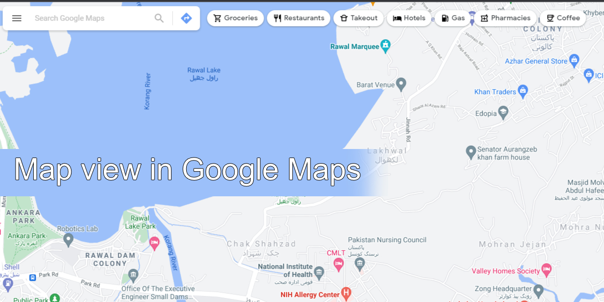
Map views in Google Maps
Google Maps offers a few different views for maps; default (simplified map view), satellite, and terrain. You can add layers for transit, traffic, bicycling, 3D, COVID-19 info, Air Quality, Wildfires, and Street View to these maps. Here’s how you can change the map view in Google Maps.
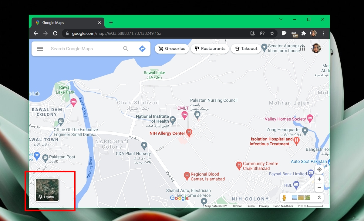
Change map view in Google Maps – Desktop
To change map view in Google Maps on the desktop (in your internet browser), follow these steps.
- Open Google Maps in the web browser.
- At the bottom left corner, click the Layers button.
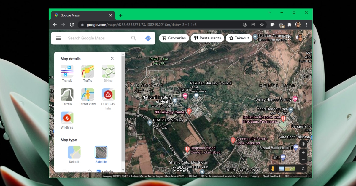
- Select More from the panel.
- Choose the Map type.
- Select an option under Map details.
- The map will be updated.
Change map view in Google Maps – Mobile
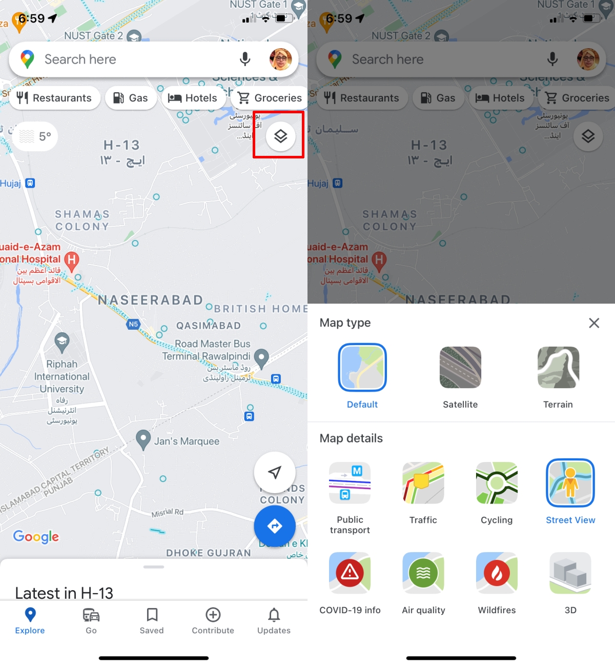
To change map view in Google Maps, follow these steps.
- Open Google Maps.
- Tap the layers button at the top right.
- From the menu that opens, select a view: Default, Satellite, or Terrain.
- From the Map Details section enable any one of the detail options.
- Return to the map and the view will be updated.
Data limitations
Google Maps will present the same or a few more options in map details. Some options like traffic will be available everywhere. For others, like Wildfires and Air quality, the information may not always be visible. You may see different options on the desktop than you do on the mobile apps. Google is not able to collect the same level of information in all countries or it isn’t able to get the information from a reliable source. In this case, it will simply not show the information.
The traffic information is almost always available though its accuracy may vary. Google Maps can be fooled into thinking there is traffic jam if there are multiple phones in the same location that aren’t moving. Likewise, if a country has low cell phone usage or mobile internet coverage is sparse, you may not know if there is a traffic jam or not.
Conclusion
The default view in Google Maps is best for when you need to follow directions. Satellite view for many places doesn’t update often and it’s far more complicated to follow, as is the terrain view. That said, lots of people use Google Maps for more than navigation and the additional information can be useful.